About this sheet
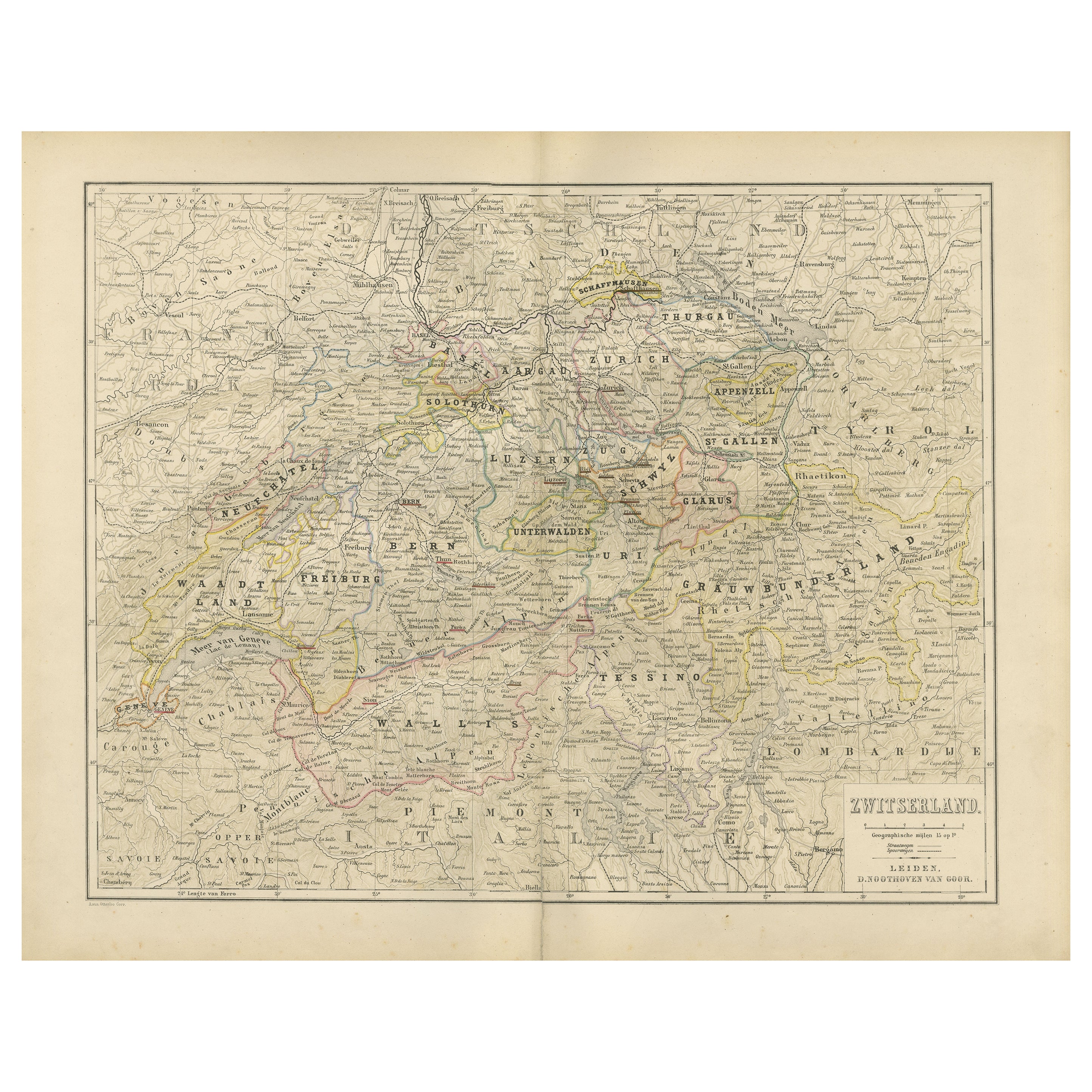
Map of Switzerland with Cantonal Boundaries – Nieuwe Hand-Atlas, 1876
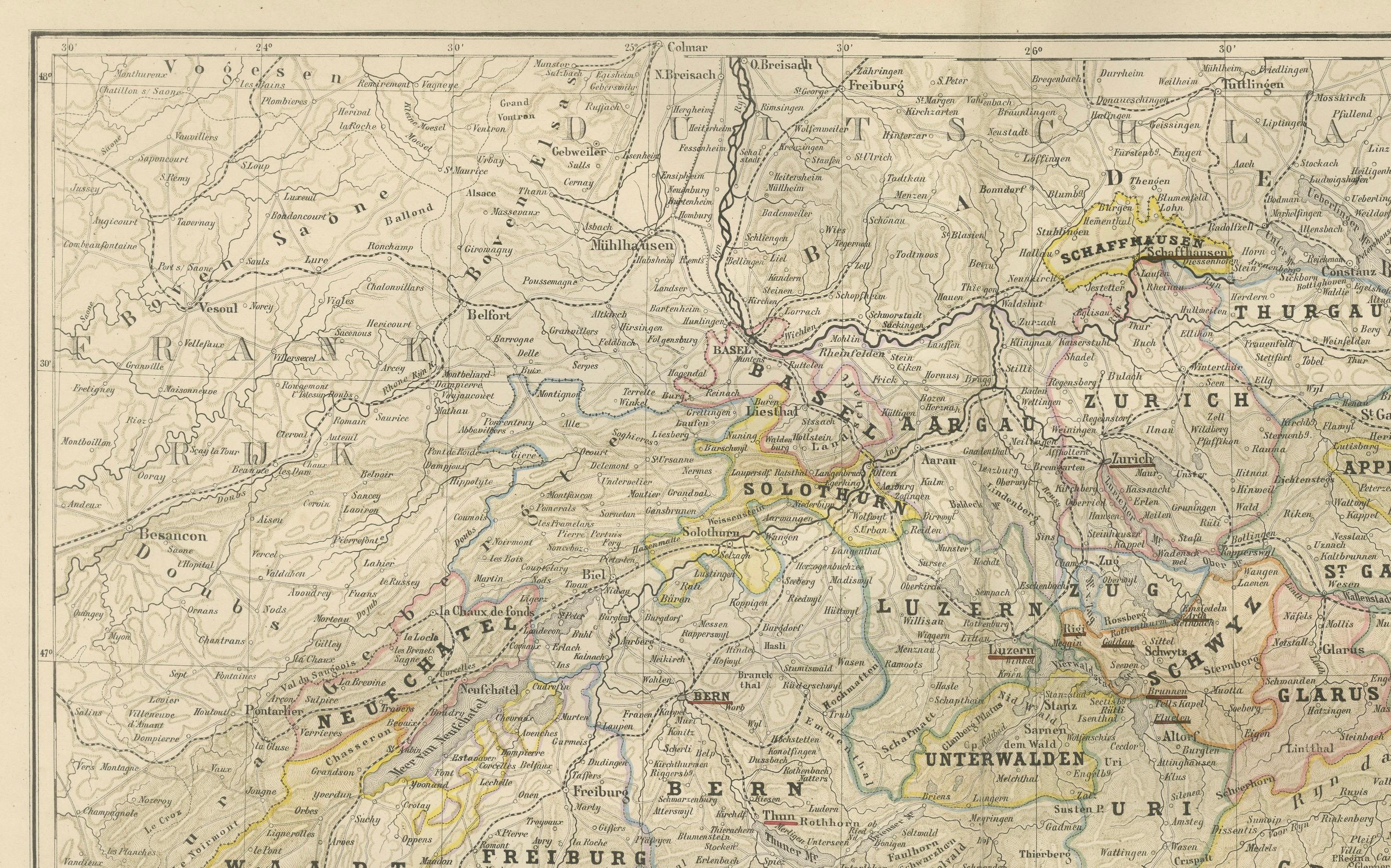
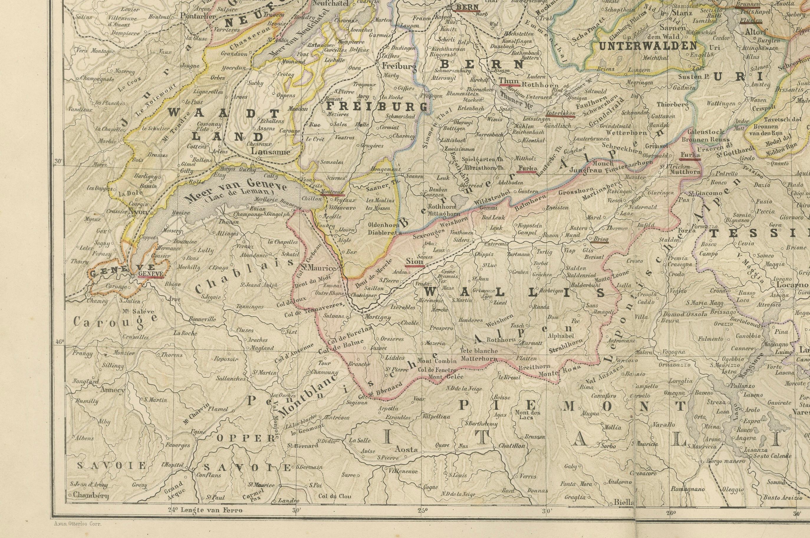
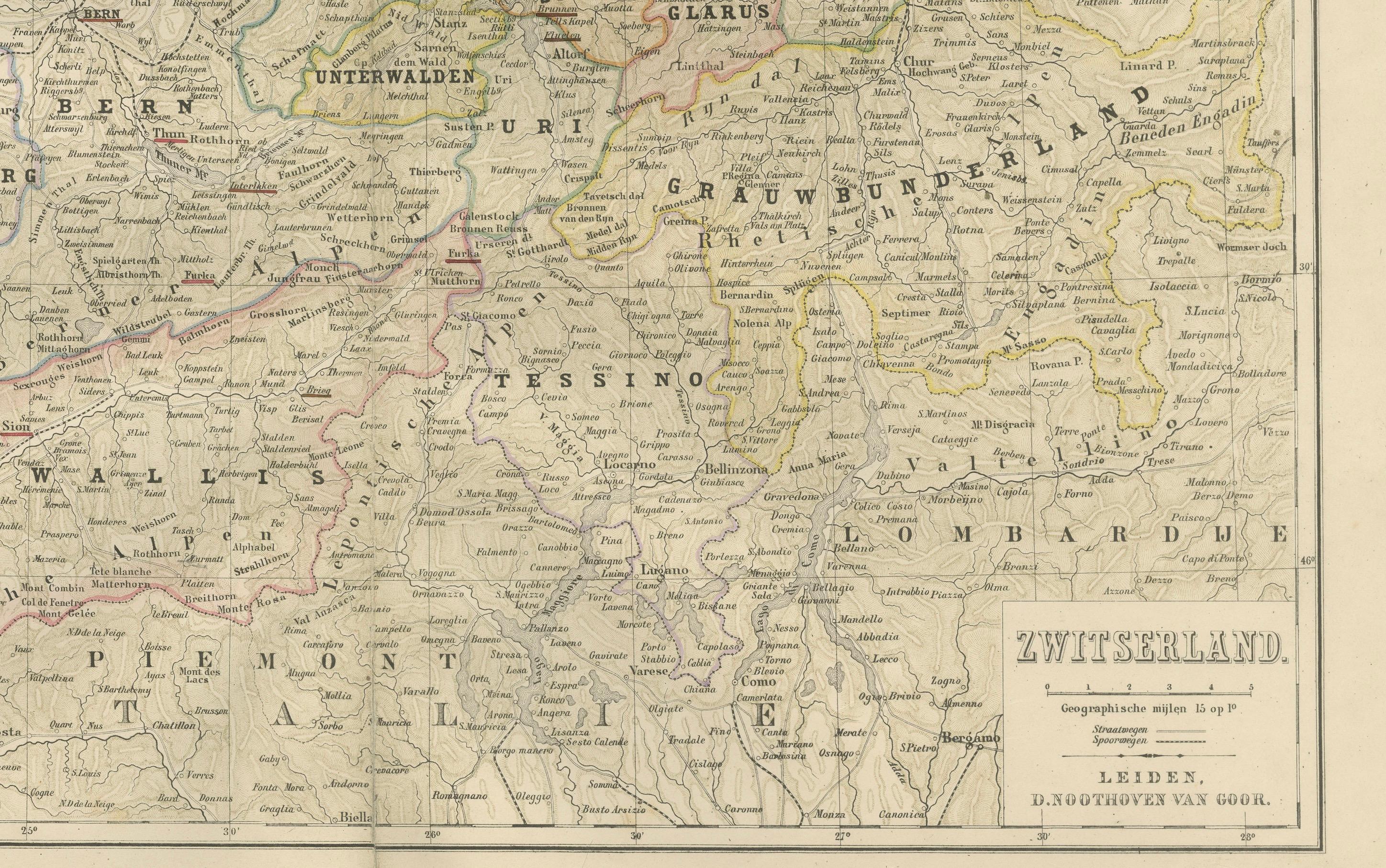
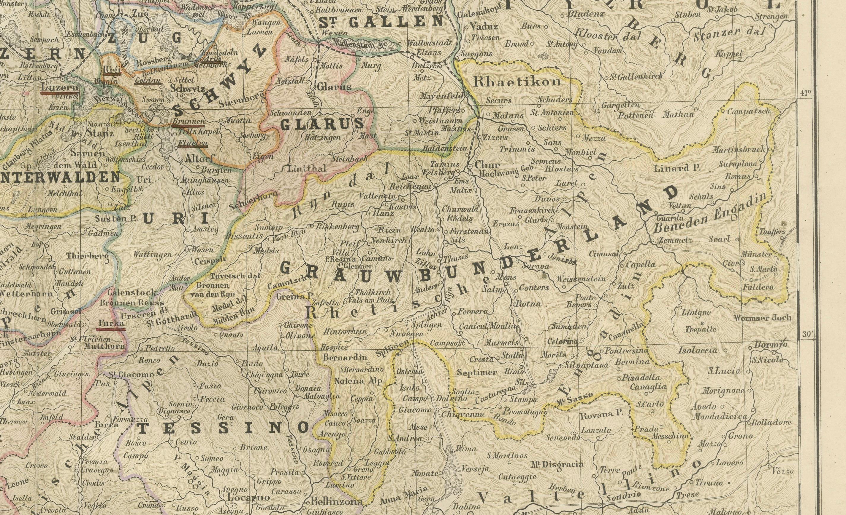
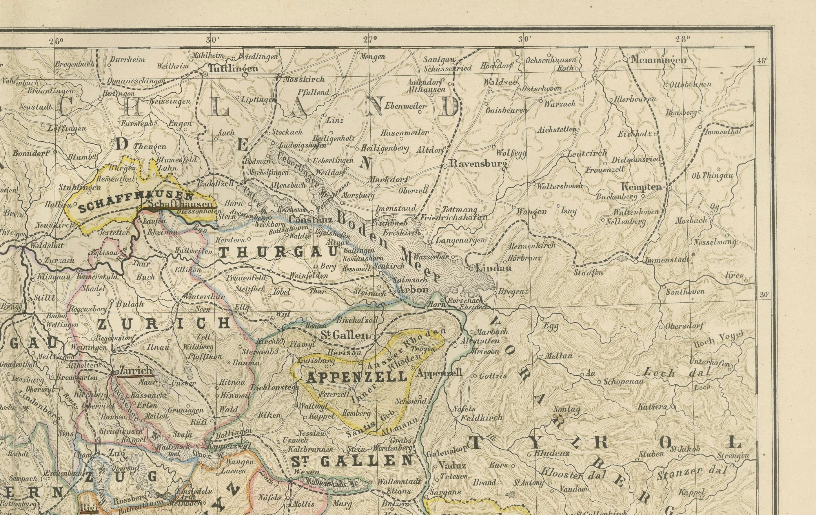
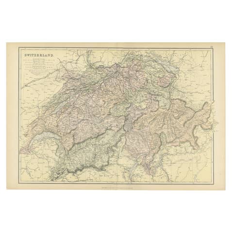
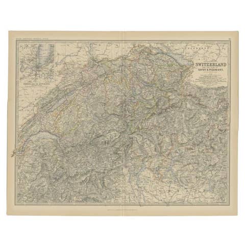
This finely detailed 19th-century map, titled “Zwitserland,” was published in 1876 in the *Nieuwe Hand-Atlas der Aarde in haren Tegenwoordigen Toestand* by M. Frijlink, revised by A. van Otterloo, and printed by D. Noothoven van Goor in Leiden. The map presents the Swiss Confederation in the late 19th century, depicting its cantonal divisions, mountainous terrain, and major waterways with exceptional clarity and precision.
Each canton is outlined in subtle hand-colored borders in red, yellow, green, and violet, while the topography is finely rendered through delicate hachuring to convey the rugged alpine landscape. Major cities and regions such as Geneva, Zurich, Bern, Lucerne, and Basel are clearly labeled, along with key lakes, including Geneva, Neuchâtel, Thun, and the Vierwaldstättersee. The map also notes neighboring territories, from Savoy and Lombardy to Tyrol and Baden, situating Switzerland within its Central European context.
This plate demonstrates the remarkable skill of Dutch map engraving and lithography of the late 19th century. Designed for educational use, it combines geographical accuracy with visual refinement, characteristic of the Leiden publisher Noothoven van Goor. Frijlink’s *Nieuwe Hand-Atlas* was a standard reference for Dutch schools, merging beauty and practicality in geographic education.
Condition report:
Good condition with light toning and minor foxing in the margins. Original center fold as issued. The printed image remains sharp, and the hand-coloring is fresh and even. No tears, repairs, or staining.
Framing tips:
This map’s balance of color and topographic texture makes it ideal for framing with a cream or soft ivory mat and a narrow black or walnut frame. Perfect for a study, library, or interior inspired by travel and geography.
Technique: Lithograph with original hand-coloring
Maker: M. Frijlink & A. van Otterloo, published by D. Noothoven van Goor, Leiden, 1876
Most Important Places (Geographic & Urban Highlights)
These are the principal cities, regions, lakes and mountain areas clearly shown on the map and typically considered important historically or geographically:
Major Cities & Towns:
Geneva, Lausanne, Vevey, Montreux, Neuchâtel, Biel/Bienne, Fribourg, Bern, Thun, Interlaken, Lucerne, Zurich, Winterthur, Schaffhausen, St. Gallen, Appenzell, Glarus, Chur, Sion, Brig, Basel, Aarau, Solothurn, Zug, Altdorf, Bellinzona, Lugano, Locarno.
Key Lakes:
Lake Geneva (Lac Léman), Lake Neuchâtel, Lake Thun, Lake Brienz, Lake Lucerne (Vierwaldstättersee), Lake Zurich, Lake Zug, Lake Constance (Bodensee), Walensee, Lake Maggiore.
Important Mountain Regions:
Alps, Pennine Alps, Bernese Oberland, Graubünden Alps, Gotthard region, Simplon region.
Border Regions Noted:
Savoye (Savoy), Piëmont, Lombardia, Tirol, Baden, Württemberg, Elsass (Alsace).
All Cantons + Major Places:
Switzerland, Zwitserland, Geneva, Geneva Lake, Lausanne, Vevey, Montreux, Neuchâtel, Fribourg, Bern, Thun, Interlaken, Lucerne, Zurich, Winterthur, Schaffhausen, St. Gallen, Appenzell, Glarus, Chur, Sion, Brig, Basel, Aarau, Solothurn, Zug, Altdorf, Bellinzona, Lugano, Locarno, Lake Geneva, Lake Neuchâtel, Lake Thun, Lake Brienz, Lake Lucerne, Lake Zurich, Lake Zug, Lake Constance, Walensee, Lake Maggiore, Alps, Bernese Oberland, Graubünden, Gotthard, Simplon, Savoy, Lombardy, Tyrol, Baden, Württemberg, Alsace, Canton Zürich, Canton Bern, Canton Luzern, Canton Uri, Canton Schwyz, Canton Obwalden, Canton Nidwalden, Canton Glarus, Canton Zug, Canton Fribourg, Canton Solothurn, Canton Basel-Stadt, Canton Basel-Landschaft, Canton Schaffhausen, Canton Appenzell Ausserrhoden, Canton Appenzell Innerrhoden, Canton St. Gallen, Canton Graubünden, Canton Aargau, Canton Thurgau, Canton Ticino, Canton Vaud, Canton Valais, Canton Neuchâtel, Canton Geneva, Canton Jura (historical territory shown as Bernese Jura).