Mid 19th Century Map of the Black Sea with Decorative Vignettes, 1851
€ 450
One of a kind: this is the sheet in the photographs. Ships from Langweer, the Netherlands.
Date
1851
Sheet size
27.5 × 36 cm (10.8 × 14.2 in)
Condition
Good
Reference
BG-13121-1
Condition
Good overall condition, some minor age toning. Please note that this is a folding map.
About this sheet
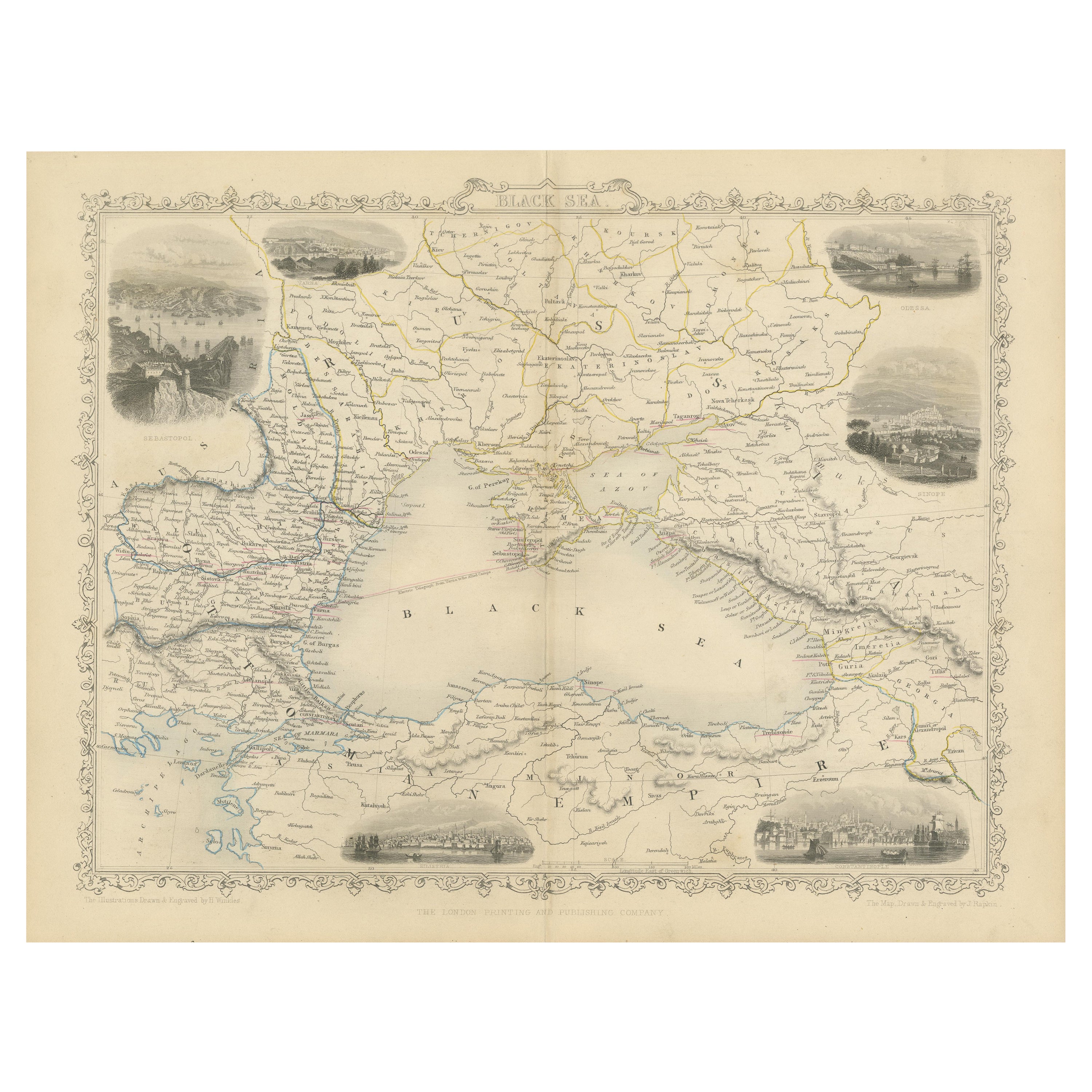
Map of the Black Sea and contingent lands, including Turkey, Russia, Georgia, Azerbaijan, Bulgaria, Crimea and Armenia, with decorative vignettes views of Sebastopol, Varna, Odessa, Sinope, Constantinople and Silistria.
Fine antique map of the Black Sea, illustrations & Engraved by H. Winkles. The Map Drawn & Engraved by J. Rapkin, decorative vignettes Sebastopol, Varna, Odessa, Sinop,(Turkey) Silistria (Bulgaria) and Constantinople.
Antique steel engraved map with original outline hand colour The London Printing and Publishing Company – Limited. (active circa 1800-1855), Printers and publishers. Lithograph in hand coloring.
Cartographer: John Tallis (1838-51) founder of Tallis and Co., London map publishers who traded under various names: L. Tallis, Tallis & co, John Tallis, John Tallis & co. (London & New York) between 1838 and 1851. After 1850-51, their maps were published by the London Printing and Publishing Co., London and New York. The Illustrated Atlas of the World, published in 1849 with the maps and decorative vignette’s engraved and drawn by J. Rapkin, was one of the last atlases to be truly decorated and is therefore highly prized.