Boundary Marker at St. Croix River Source, 1817 – A Historic Diplomatic Monument
€ 270
Original antique · The actual sheet photographed · Certificate of authenticity on request · Sold unframed · Worldwide shipping from € 15 (rates)
Date
1817
Sheet size
21 × 25.6 cm (8.3 × 10.1 in)
Condition
Good
Reference
BG-13600-84
What the condition grades mean
Excellent
Bright and clean, with no faults worth mentioning.
Very good
Only light signs of age, such as faint toning.
Good
Normal signs of age for a sheet of this period: toning, some foxing, small marks or neat old repairs.
Fair
Clear faults such as staining, tears or repairs, priced to match.
Every fault we see is written in the condition note, and the whole sheet is shown uncropped in the photos.
Condition
Very good condition with vibrant coloring, intact margins, light foxing, and minimal toning; an important and well-preserved historical lithograph for collectors.
About this sheet
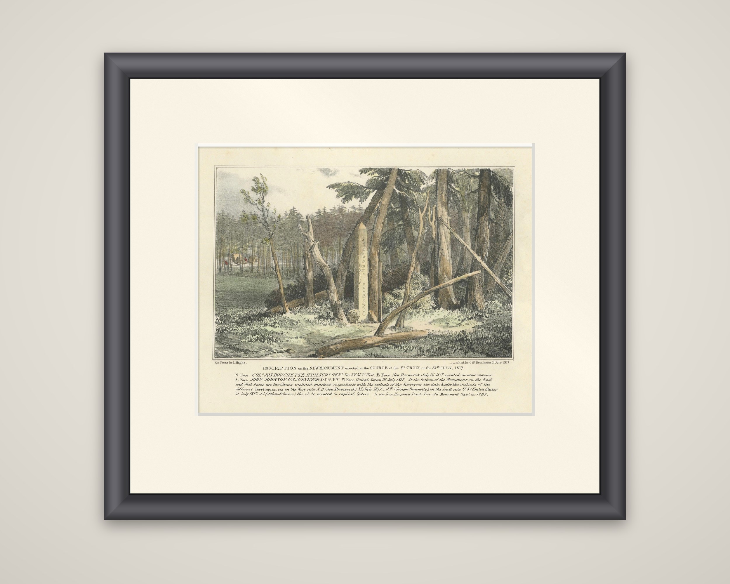
The monument erected at the source of the St. Croix River on 31 July 1817, a hand-colored lithograph on stone by L. Haghe after a sketch by Colonel Joseph Bouchette, surveyor general of Lower Canada. The sheet is lettered "Inscription on the new monument erected at the source of the St. Croix on the 31st July, 1817," and was published about 1831 in Bouchette's The British Dominions in North America.
The image shows a tall stone shaft standing in a forest clearing among slender spruces and fallen logs, with the inscription running down its face and surveyors' tents visible in the woods at the left. The long caption beneath gives the lettering on the four faces: Bouchette's name and title on the north face, "New Brunswick, July 31, 1817" on the east, the name of John Johnson, U.S. Surveyor, on the south, and "United States, July 31, 1817" on the west. At the foot are two inclined stones marked NB and US with the surveyors' initials, and an iron hoop on a beech tree is noted as the old monument of 1797.
The source of the St. Croix was the starting point of the boundary between New Brunswick and the United States set by the Treaty of 1794 and its commission.