

Maps & PrintsBartele Gallery · Langweer
Home / Antique Maps / Africa

Africa

Antique Map of the Pyramids of Saqqara and Dahshur – Egypt, c.1770s

€ 180

Original antique · The actual sheet photographed · Certificate of authenticity on request · Sold unframed · Worldwide shipping from € 15 (rates)

Mapmaker / artist
After Cornelis de Bruijn, The Netherlands, early 18th century
Technique
Copperplate engraving
Sheet size
27 × 37.5 cm (10.6 × 14.8 in)
Condition
Good
Reference
BG-14102-67
What the condition grades mean
Excellent
Bright and clean, with no faults worth mentioning.
Very good
Only light signs of age, such as faint toning.
Good
Normal signs of age for a sheet of this period: toning, some foxing, small marks or neat old repairs.
Fair
Clear faults such as staining, tears or repairs, priced to match.

Every fault we see is written in the condition note, and the whole sheet is shown uncropped in the photos.

Condition

Good condition. Vertical fold lines as issued. Minor wear to the outer margins. Printed area remains clean and crisp with good contrast.
About this sheet

Antique Map of the Pyramids of Saqqara and Dahshur – Egypt, c.1710s
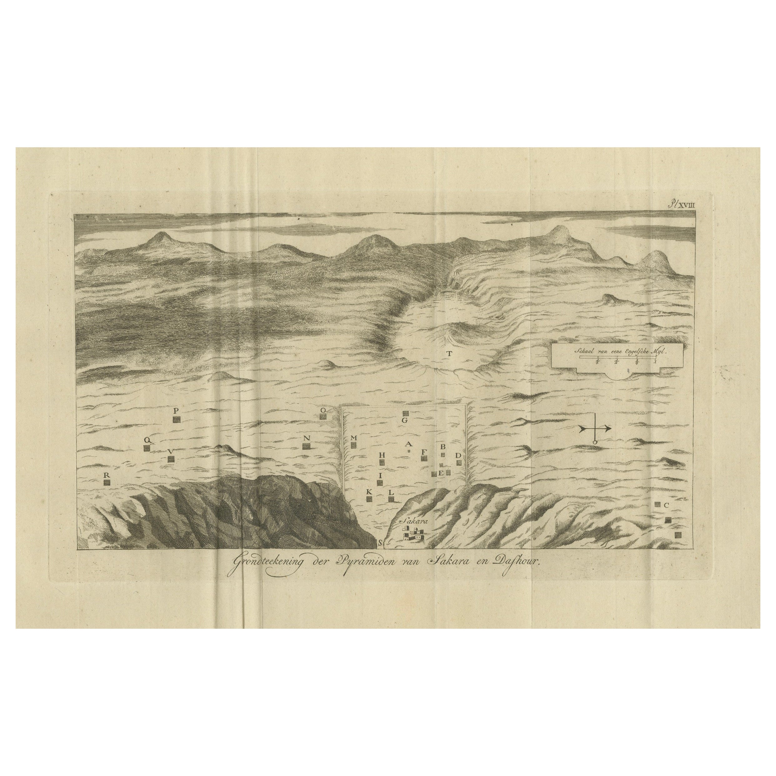
This rare early 18th-century engraving presents a bird’s-eye topographic plan of the pyramids of Saqqara and Dahshur in Lower Egypt. Titled in Dutch "Grondteekening der Pyramiden van Sakara en Dafhour," this map was created during a period of increasing European interest in ancient Egypt and likely originates from the Dutch edition of Cornelis de Bruijn’s Reizen door de vermaardste Deelen van Klein Asia, published in The Hague between 1711 and 1724, but it can also be used in later work.

The image illustrates the desert plateau landscape, with individual pyramids and tombs plotted in a schematic manner and marked with capital letters corresponding to an index (likely in the original text). The map captures not only the pyramids of Saqqara—home to the famous Step Pyramid of Djoser—but also the Red Pyramid and Bent Pyramid of Dahshur, forming part of the great necropolis of Memphis.

The illustration combines cartographic elements with artistic license, with mountainous terrain rendered in soft hachure and the pyramids depicted from an elevated diagonal perspective. The map offers a clear spatial overview of pyramid locations, paths, and surrounding structures, such as temples or ruins, drawn in outline.

Cornelis de Bruijn (1652–1726/27) was a Dutch traveler and artist known for his vivid engravings and pioneering travel literature. His works are among the earliest European attempts to systematically document ancient Egyptian monuments, predating the Napoleonic expeditions by nearly a century.

Good condition. Vertical fold lines as issued. Minor wear to the outer margins. Printed area remains clean and crisp with good contrast.
Framing tips:
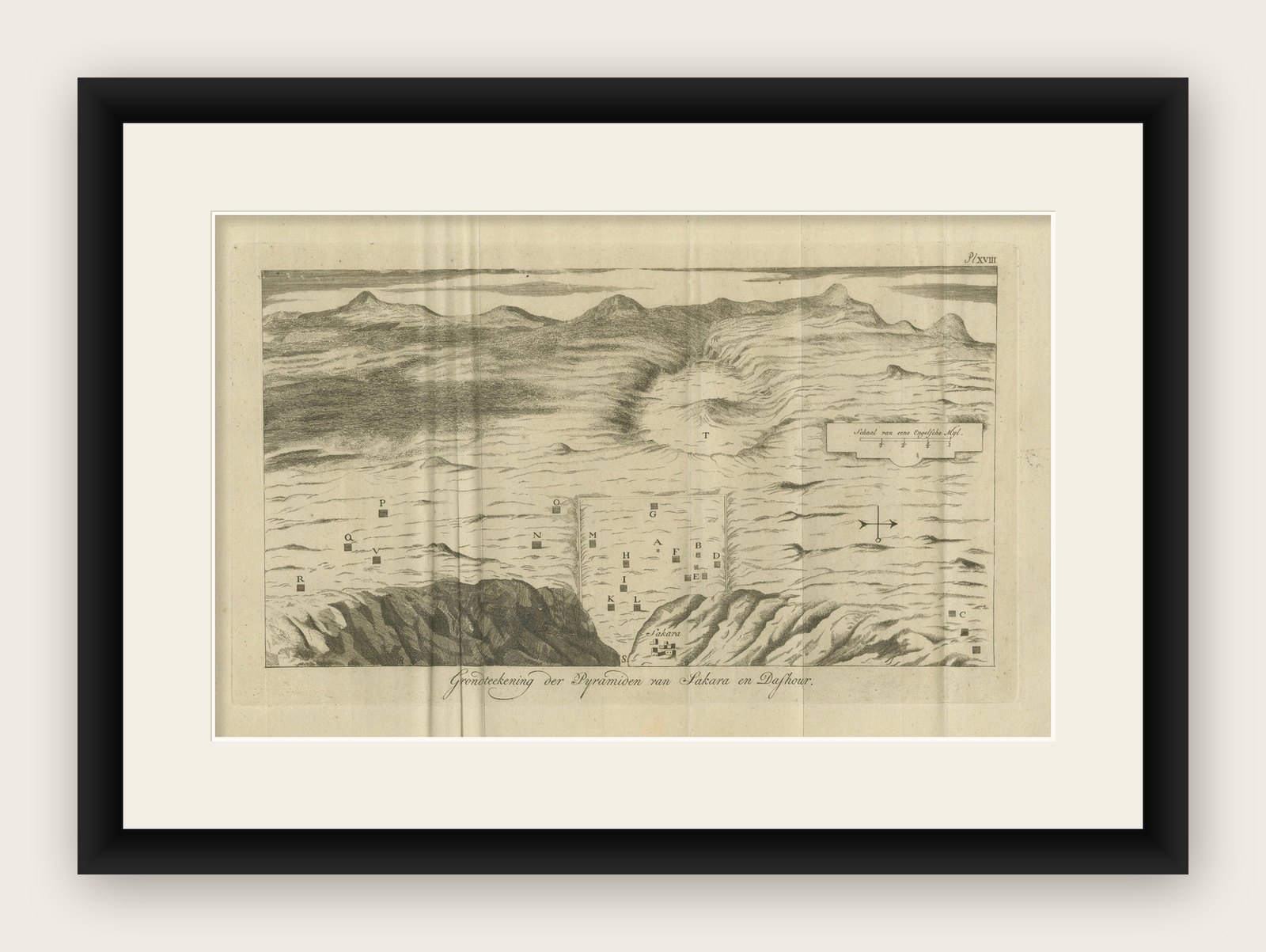
This print would benefit from a light ivory or sand-colored mat and a slim black or walnut frame. To enhance the historic character, consider a hand-gilded wooden frame or museum glass for archival presentation.

More from Africa

Ask about this sheet

Antique Map of the Pyramids of Saqqara and Dahshur – Egypt, c.1770s
Ref. BG-14102-67 · € 180
We reply by email, usually within one working day.

Your favorites

Saved in this browser. Email the list to yourself to keep it on any device.

We use your email to send this list and, only if you tick the box and confirm, for occasional new arrivals. Every email has an unsubscribe link. Bartele Gallery, the Netherlands.