Venetian Fortress Paleokastro on Crete – Antique Print, Hand-Colored, 1688
€ 320
Original antique · The actual sheet photographed · Certificate of authenticity on request · Sold unframed · Worldwide shipping from € 15 (rates)
Date
1688
Mapmaker / artist
Olfert Dapper, Amsterdam, 1688
Technique
Hand-colored copper engraving
Sheet size
29.6 × 20.4 cm (11.7 × 8.0 in)
Condition
Good
Reference
PCT-62796
What the condition grades mean
Excellent
Bright and clean, with no faults worth mentioning.
Very good
Only light signs of age, such as faint toning.
Good
Normal signs of age for a sheet of this period: toning, some foxing, small marks or neat old repairs.
Fair
Clear faults such as staining, tears or repairs, priced to match.
Every fault we see is written in the condition note, and the whole sheet is shown uncropped in the photos.
Condition
Strong hand coloring, some age toning, light browning to margins, and faint spotting consistent with age. Plate mark visible. Reverse with uncolored engraving of Belveder Castle.
About this sheet
Antique Print of Paleokastro Castle on Crete, Dapper, 1688
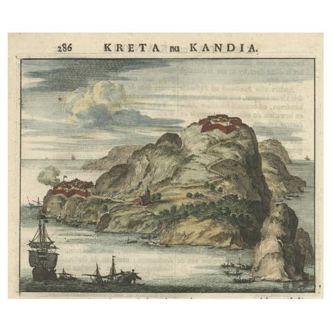
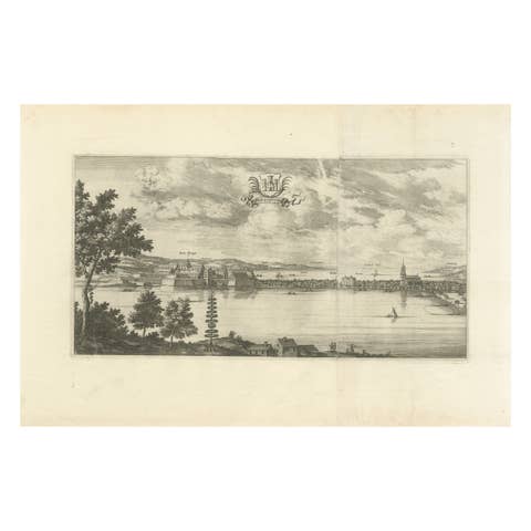
This fine hand-colored engraving depicts the fortress of Paleokastro (Palaiokastro) on the north coast of Crete. The view shows the fortress dramatically positioned on a rocky promontory overlooking the sea, with ships sailing in the foreground and rugged mountains in the background. A small river valley with soldiers, cannon fire, and smoke suggests military activity, emphasizing Crete’s strategic importance during Venetian and Ottoman conflicts.
The accompanying Dutch text provides a detailed description of Paleokastro:
“Kastel of Kasteel Paleokastro, aan de Noordzijde des eilants gelegen. Paleokastro – that is a half-broken Greek and Latin word; in Dutch it means as much as ‘old castle’. It lies on the north side of the island, by the sea, three or about four miles west of the city of Candia, on a high cape or headland, 'punta della Fraschia' as the Venetians call it, or rather on the eastern side of the same headland, and it has the island Standia to the north opposite it. Between this Paleokastro and the city of Candia there are four rivers: Armirro, Gazé, Xeropotamo, and Gioffro, all of which flow northward into the sea. Some miles southwest of Paleokastro lies a high mountain inland, called 'Santo Paulo', the mountain of Saint Paul, with a house or hermitage on the top. Paleokastro is divided into three parts or districts: 'Piazza Alto' (upper square), 'Piazza di Mezzo' (middle square), and 'Piazza da Basso' (lower square).”
The print was published in Olfert Dapper’s 'Naukeurige Beschrijving der Eilanden in de Archipel der Middelantsche Zee' (Accurate Description of the Islands in the Archipelago of the Mediterranean Sea), Amsterdam, 1688. Dapper (c.1635–1689), although he never traveled outside the Netherlands, compiled richly illustrated works on Africa, Asia, and the Mediterranean that remain important historical sources.
This engraving offers not only a striking image of Crete’s Venetian-era fortifications but also a rare 17th-century description of the site. For collectors of antique maps and views, or those with an interest in Venetian-Ottoman history, it represents both artistic and documentary value.
Framing tips: A walnut or dark wood frame with a cream mat will highlight the hand-coloring. For a more dramatic display, a gilt frame with a wide mount would suit its 17th-century style.