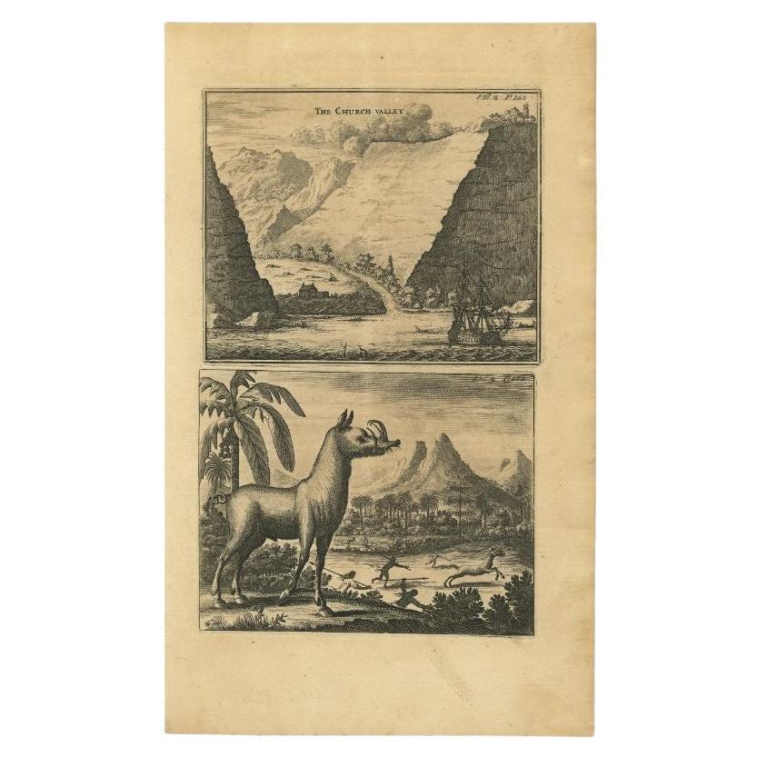
Antique Print of Church Valley on the Island of St. Helena and a Hunting Scene
€ 150
One of a kind: this is the sheet in the photographs. Ships from Langweer, the Netherlands.
Mapmaker / artist
Johannes Nieuhof (Artist)
Sheet size
33.8 × 20.5 cm (13.3 × 8.1 in)
Condition
Good
Reference
PCT-61627
Condition
given age. Paper slightly browned. Plate edges in the middle reinforced on verso. General age-related toning and/or occasional minor defects from handling. Please study image carefully.
About this sheet
Antique print titled 'The church valley.' This plate shows two engravings; view of the Church Valley on the island of St. Helena in the Atlantic Ocean. Below a warthog and a hunting scene with African natives. Published in Churchill's 'A Collection of Voyages and Travels, some now first printed from original manuscripts others now first printed in English', printed in 1744 for Henry Lintot. First published in 1682.
Artists and Engravers: Johan / Jan / Johannes Nieuhof / Nieuhoff / Neuhof (1618-1672) was a Dutch traveler who wrote about his journeys to Brazil, China and India. The most famous of these was a trip of 2,400 km from Canton to Peking in 1655-1657 as part of a Dutch envoy, which enabled him to become an authoritative Western writer on China. Johan Nieuhof was born in Uelsen, Germany, of which his father (originally from Zwolle) was mayor. Nieuhof left for Brazil in 1640 as a reserve officer-candidate - from then on, barring two short family visits in 1658 and 1671, he spent all the rest of his life abroad. After an adventurous career in the service of the Dutch East India Company (or VOC) - between 1660 and 1667 he occupied posts in India and on Ceylon - he then lived in Batavia until 1670. He then disappeared without trace on Madagascar, traveling in a sloop from which he had landed to seek drinking water. The engravings are made after Nieuhoff's drawings.
Condition: Good, given age. Paper slightly browned. Plate edges in the middle reinforced on verso. General age-related toning and/or occasional minor defects from handling. Please study image carefully. Date: 1744 Overall size: 20.5 x 33.8 cm. Image size: 16.3 x 25.8 cm.
We sell original antique maps to collectors, historians, educators and interior decorators all over the world. Our collection includes a wide range of authentic antique maps from the 16th to the 20th centuries. Buying and collecting antique maps is a tradition that goes back hundreds of years. Antique maps have proved a richly rewarding investment over the past decade, thanks to a growing appreciation of their unique historical appeal. Today the decorative qualities of antique maps are widely recognized by interior designers who appreciate their beauty and design flexibility. Depending on the individual map, presentation, and context, a rare or antique map can be modern, traditional, abstract, figurative, serious or whimsical. We offer a wide range of authentic antique maps for any budget.