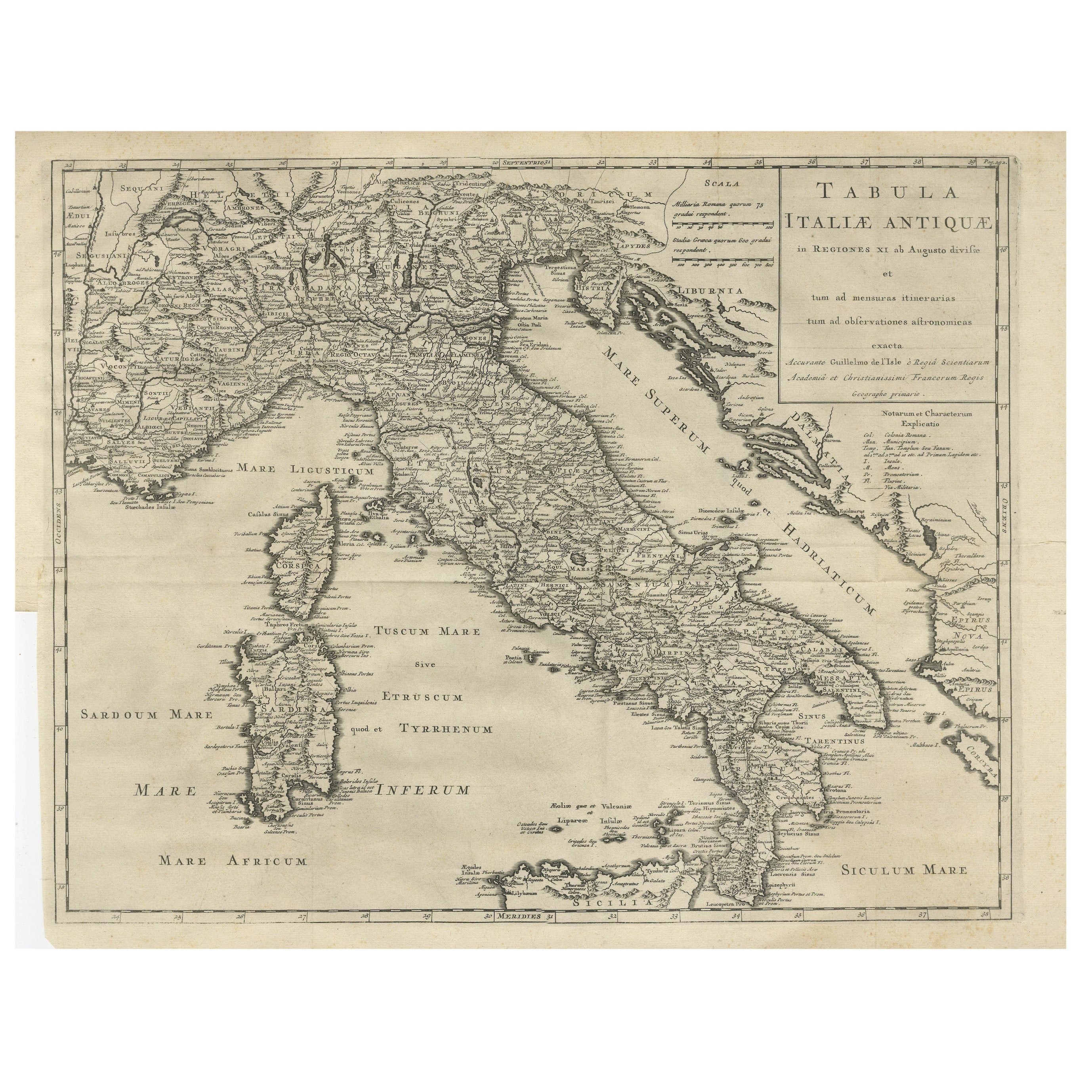
Antique Engraved Map of Italy in Roman Times, ca.1730
€ 680
One of a kind: this is the sheet in the photographs. Ships from Langweer, the Netherlands.
Date
1730
Sheet size
42.5 × 55 cm (16.7 × 21.7 in)
Condition
Good
Reference
BG-13135-3
Condition
Minor overall aging, slightly browning and some wrinkles. Folds as issued, visible but flattened, making this map very suitable for colouring and/or framing.
About this sheet
Plain engr. map of Italy according to the division of Emperor Augustus by G. Delisle.
Title: "Tabula Italiae Antiquae In Regiones XI Ab Augusto Divisae Et Tum Ad Mensuras Itinerarias Tum Ad Observationes Astromicas Exacte"
The map shows Italy, Corsica, Sardinia and parts of the Mediterrean, including Minora and part of Majorca and Sicily. Richely printed classical map of ancient kingdoms and city states and showing towns, mountains, rivers, lakes, bays, islands, gulfs, etc.
Minor overall aging, slightly browning and some wrinkles. Folds as issued, visible but flattened, making this map very suitable for colouring and/or framing.
Guillaume Delisle (1675-1726) was a French map maker who continually updated his maps and dispelled prevailing geographical inaccuracies throughout his life.