About this sheet
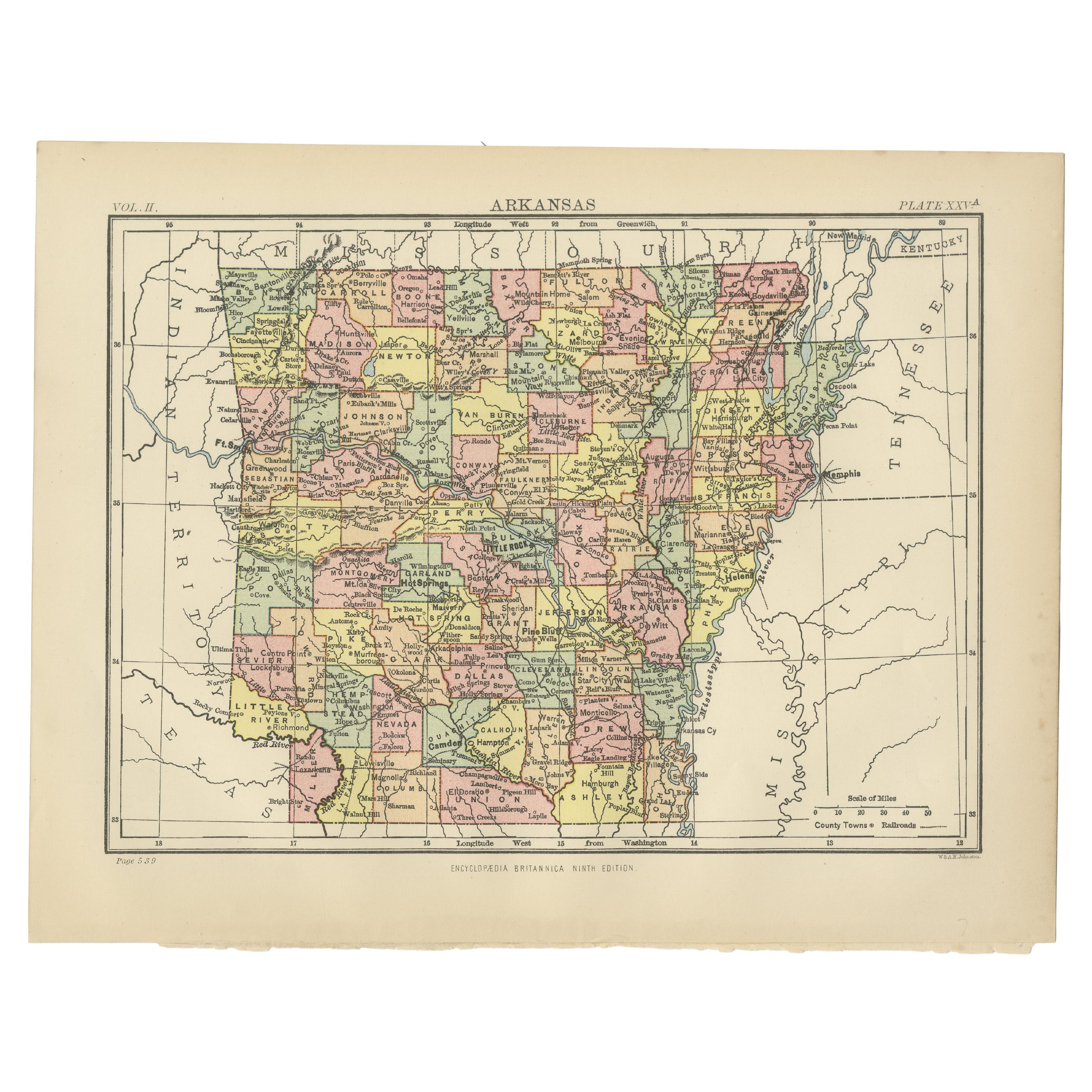
Antique Map of Arkansas from Encyclopaedia Britannica, 1875
Original antique map of the U.S. state of Arkansas, published in 1875 for the Ninth Edition of the Encyclopaedia Britannica. This finely detailed map presents the state divided into counties, each highlighted in contrasting hand-applied color wash for clarity. Railroads, rivers, towns, and county seats are all carefully engraved, offering a precise geographical record of Arkansas in the late 19th century.
The map situates Arkansas in relation to its neighbors — Missouri to the north, Tennessee and Mississippi to the east, Louisiana to the south, and Texas to the west. Notable geographical features such as the Arkansas River, White River, and Ouachita Mountains are depicted, providing historical context for the state’s transportation routes, settlements, and economic development.
As part of the *Encyclopaedia Britannica*, these maps were designed to combine scholarly accuracy with visual appeal. They reflect a period when cartographic publishing was flourishing in both Europe and America, offering accessible yet detailed geographical knowledge to a wide readership.
This Arkansas map stands as both a decorative item and a valuable historical document, illustrating the administrative and transport infrastructure of the state just a decade after the American Civil War, when population growth and industrial development were transforming the South.
Condition report:
Very good condition. Minor toning to margins consistent with age, light handling marks. Original hand coloring remains clear and vibrant. Blank verso. Please study the images carefully.
Framing tips:
A classic black or walnut frame will enhance the strong boundary lines of the counties, while a cream or ivory mount will brighten the pastel tones. For a more academic or library-style presentation, consider a dark green mat with gilt-lined frame, emphasizing the historic character of the piece.
Technique: Lithograph with original hand coloring
Maker: Encyclopaedia Britannica, Ninth Edition, Edinburgh, 1875
The Encyclopædia Britannica has been published continuously since 1768, appearing in fifteen official editions. Several editions have been amended with multi-volume "supplements" (3rd, 5th/6th), consisted of previous editions with added supplements (10th, and 12th/13th) or gone drastic re-organizations (15th). In recent years, digital versions of the Britannica have been developed, both online and on optical media. Since the early 1930s, the Britannica has developed several "spin-off" products to leverage its reputation as a reliable reference work and educational tool. The Encyclopedia as known up to 2012 was incurring unsustainable losses and the print editions were ended, but it continues on the Internet.